Projects and Fieldwork
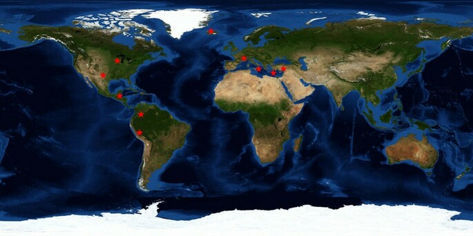
Our research group is currently conducting research in the following locations:
|
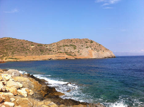
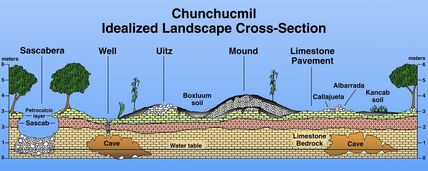
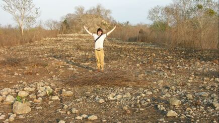
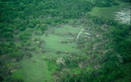
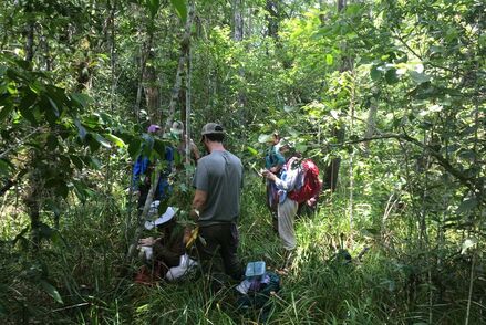
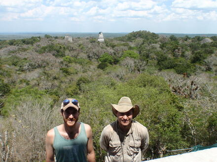
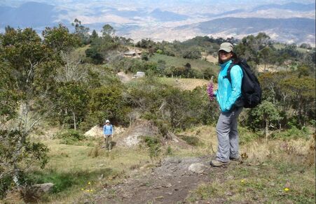
Mexico Our work in Mexico started in 1994 with the beginnings of what came to be the Chunchucmil Regional Economy Project, which also we also called the Pakbeh Project (https://en.wikipedia.org/wiki/Chunchucmil). We helped start this project with our dearly departed friend Dr. Bruce Dahlin and other colleagues like Tony Andrews and a host of students. We started by studying the coast, the Celestun Peninsula and Estuary, and the hypothesized ancient Maya site of Canbalam. Our drive was to study soils, water, and agricultural self-sufficiency around the sprawling ancient city of Chunchucmil. The NSF and NGS supported this work, as well as Georgetown and George Mason Universities. We continued working throughout the Yucatan Peninsula with Dr. Scott Hutson and Dr. Betty Faust, and now south of the Peninsula in Tabasco with Dr. Takeshi Inomata. Belize Research in Belize focuses on several sites around Belize, but always at the Maya Research Program and Program for Belize, where we started in 1993. We study the long-term environmental change, soils, hydrology, paleoclimate, and geoarchaeology of the Maya world. The work focuses on quantifying the lasting physical changes that the Maya have left on the landscape, and it includes several ongoing projects. In 1993, we established a long-term water monitoring campaign, to understand the variation in water resources quality and availability in the site. This research has helped us to better understand the hydrologic opportunities and constraints on ancient and modern land and water use in the Three Rivers watersheds and aquifers. We have also been studying sediment budgets from hillslopes to sinks in these fluviokarst watersheds. We are also studying the ancient Maya use of wetland fields for agriculture and the formation of these fields through natural and human agents over time. The lab is also creating a chronology of changing land use, captured through identification of paleosols, identification of phytoliths, and quantification of charcoal, as well as a suite of geochemical and geophysical analyses. In western Belize, the lab is involved in a project to determine the human-environment interactions that have shaped the geomorphology of the landscape over the past 4,000 years. Much of our recent research has been using a swath of 300 square km of LiDAR imagery we acquired in 2016 through NSF Grants and funds from multiple Universities. We also had generous support from the NGS and the Anne U. White Fund of the AAG. Guatemala Our work has focused on the soils, geoarchaeology, and environmental change of Guatemala's Petén Department since 1991. We have continued to work there most years to the present under the aegis of the Petxbatun, Cancuen, and El Zotz Projects with various colleagues such as Dr. Tom Garrison at Ithaca College, and Dr. Stephen Houston of Brown University. Some of this current research in Guatemala focuses on the karst geology of the region, the water resources and human-made water features of the region, as well as on the ground mapping and assessment of other human modified systems across the tropical forest surrounding El Zotz and adjacent archaeological sites. Sicily and Rome, Italy
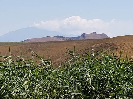
The work in Sicily and in Rome are part of the Planet Texas 2050 project, which strives to make Texas resilient to a changing environment. The Sicily project provides an analogue to the Texas Hill Country, offering a longer historical perspective through which we can study how ancient urban societies adapted to environmental changes. The city of Morgantina, which existed in central Sicily between the mid-fifth and late-first centuries BCE, offers a fascinating case study in the complex interactions between changing populations, climate, and landscape. These interactions have left landscapes that are—like the Texas Hill Country—the product of both cultural pressures and environmental change. Despite millennia of changing land-use patterns and human migrations, through climate and population stress, the Sicilian landscape continues to function as an agricultural heartland. The project combines geoarchaeological, climatological, archaeological, and archival research to present the ancient city of Morgantina as a long-term story of adaptation and resilience to environmental change. Through Planet Texas 2050, we can apply lessons learned to environmental management in the Texas Hill Country. This project is conducted in collaboration with the Contrada Agnese Project in Morgantina, in collaboration with Dr. Alex Walthall (PI, UT Classics). The research in Rome is in collaboration with Dr. Rabun Taylor (PI, UT Classics) on exploring for and mapping ancient Roman Aqueducts, and tracing and analyzing their water sources. The goal is to not only understand the achievements of ancient Roman hydraulic engineering, but to also evaluate the current contributions of this ancient water management and delivery system to the modern city of Rome. Turkey From 1995 to 2012, we studied geoarchaeology and water chemistry in Turkey near Alanya, Antalya, Antakya, and Dortyol. Most of this work focused on the Kinet Hoyuk Project, ancient Issos and surroundings. Our collaborators included Dr. Scott Redford (SOAS University of London, PI, Alanya), with whom we studied ancient Seljuk kiosks, gardens, springs, and aqueducts near Alanya; and Dr. Marie-Henriette Gates and Dr. Charles Gates (Bilkent University, PI's, Kinet Hoyuk) with whom we studied geomorphic and human-induced landscape changes on the floodplain of the Delicay River, surrounding the ancient site of Kinet Hoyuk. Colombia This project investigates soil erosion and sediment budgets near Villa de Leyva, Boyacá, Colombia. Much of this landscape is strikingly eroded, with stripped upland surfaces, remnant soil pedestals, and extensive gullying. By studying soil profiles and regional paleoclimate records (including lacustrine cores and speleothems), we aim to link Holocene soil erosion and landscape change with human and/or climatic drivers. Iceland
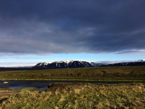
Our prior fieldwork in Iceland began in 2008 and ran through 2012, with our team of George Mason and Georgetown University students and colleagues. The work was funded by a grant from the National Science Foundation, and funds from Georgetown University and George Mason University. We returned in 2015 with our UT Team and colleagues from Georgetown University, funded by NSF-RAPID and Georgetown University grants, and with UT CB Smith Fellowship Funding, to study the potential threat of a future volcanic eruption and outburst floods. The current project (2016-present) uses geomorphologic and geochronological techniques to reconstruct a series of glacial lake outburst floods (jökulhlaups) that drained in Iceland during Late Pleistocene-Early Holocene ice sheet retreat. These floods left extensive Earth surface evidence across southwestern Iceland, including Gullfoss--Iceland's most famous waterfall. Results will place these catastrophic events in the context of Icelandic paleoenvironmental change; advance our understanding of the role of extreme events in landscape evolution; and serve as an analogue to contemporary deglaciation and jökulhlaup processes in Arctic and alpine regions across the globe. UT Project leader: Greta Wells, PhD candidate Peruvian Andes and French Alps
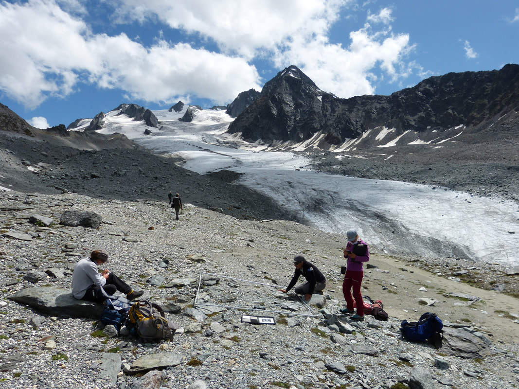
This research focuses on high alpine areas where recent deglaciation connects local landscapes to global change processes. It aims to understand how physical, ecological, and social processes interact to drive ecosystem changes in alpine periglacial landscapes and what this tells us about adaptation to sustain livelihoods and downstream services. This involves the study of primary succession, soil processes and dynamics of species assemblages. The research approach is based on field sampling, experiments, and UAV aerial imagery. This project takes place in multiple sites in the Tropical Andes and the French Alps, setting up a biogeographical comparison between continents. UT Project leader: Anaïs Zimmer, PhD student |
|
|